Politics & Government
NYS Cancer Map Shows Cases
Breaks down where people are suffering by block, zip code or area.

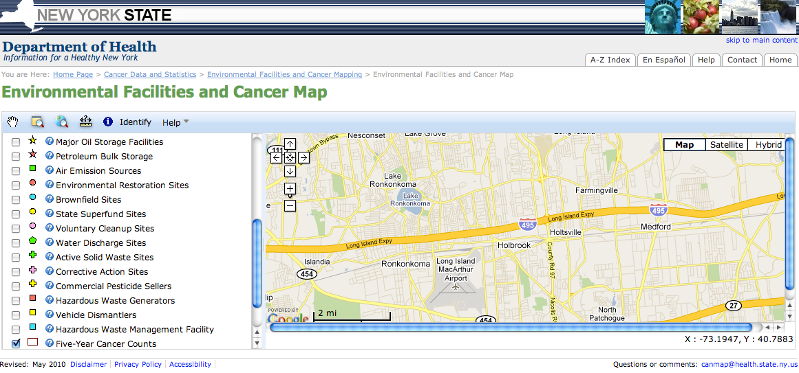
New York State launched an Environmental Facility and Cancer Map Monday that shows the number of people diagnosed with cancer for the years 2003-2007 in small geographic areas of the state.
A list of 23 of the most common types of cancer are used for this project.
Locations of certain environmental facilities can also be viewed, but these maps cannot show that an environmental facility causes cancer in a community for a variety of reasons, the state said.
Find out what's happening in Sachemwith free, real-time updates from Patch.
The state stresses some important points before viewing the maps:
-Cancer is much more common among older people, so communities with older populations are likely to have more cancer cases.
Find out what's happening in Sachemwith free, real-time updates from Patch.
-It does not contain any information about whether chemicals are released from these facilities or the likelihood that people may have been exposed to any chemicals that could cause cancer.
-The map doesn't contain any information about important known individual risk factors for cancer. This includes factors such as tobacco use, alcohol use, radiation exposure, infections, diet, sunlight, physical activity and family history, which are known to play important roles in what causes cancer.
-It is possible that people with cancer lived elsewhere before their diagnosis. This is important because cancer can take many years (5 to 40 years) to develop. This is referred to as cancer latency. People's exposures earlier in life, at a different address, may have contributed to their cancer.
-This is the most recent population information available for areas of this size. Because the number of residents in each area is likely to have changed since 2000, comparisons of the number of cancer cases to the population shown should be made with caution.
The following facilities are shown on the map:
- Water discharge sites
- Petroleum bulk storage
- Title V and State Air facilities
- Hazardous waste management facilities
- Active Solid Waste Sites
- Large quantity hazardous waste generators
- Brownfields
- State Superfund Program inactive hazardous waste sites
- Vehicle dismantling facilities
- Commercial pesticide sellers
- Chemical bulk storage facilties
- Environmental Restoration Program facilities
- Resource Conservation and Recovery Act (RCRA) Corrective Action sites
- Voluntary Cleanup Program sites
- Major oil storage facilities
The state said over the next several years, statistical analyses will be conducted to identify any unusual patterns of cancer in small geographic areas.
Get more local news delivered straight to your inbox. Sign up for free Patch newsletters and alerts.


